The Snake River Basin - Eastern Reach Maps

Included on this page are maps of the following Snake River Reaches:

1.  Upper Snake River Reach

2.  Blackfoot to Neeley Reach

3.  Neeley to Minidoka Reach

4.  Kimberly to King Hill Reach.

Mouse over the link above to see the image to the right.
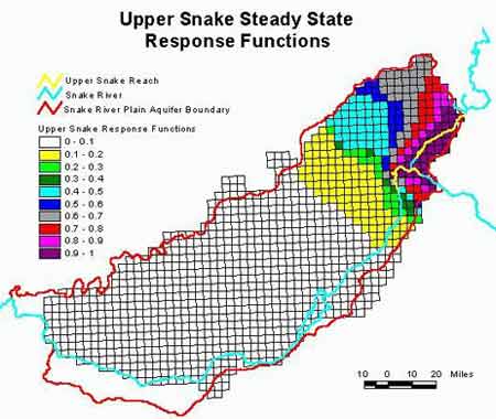

Information supplied by Idaho Water Resource Research Institute, University of Idaho December 1998
Authors: Dr. Gary Johnson, Donna Cosgrove, and Mark Lovell.
Graphics: Sherry Laney and Mark Lovell of Idaho Water Resource Research Institute.
All State of Idaho images and graphics created with GIS files obtained through Idaho Department of Water Resources Public Domain GIS unless otherwise noted.
Source Information