Snake River
Basin: Water Level Measurements
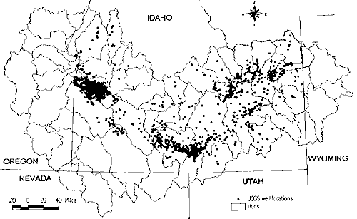
The water table data from monitoring wells, provided by the USGS, contains measurements
from more that 1300 wells within that portion of the Snake River Basin located
in Idaho (see figure below). A summary of the information obtained from these
wells is published by the U.S. Geological Survey in cooperation with the State
of Idaho and other agencies in their annual report entitled Water Resources Data-Idaho.
The majority of wells are located within those regions where competition for water
has been more intense, such as the Eastern Snake River Plain.
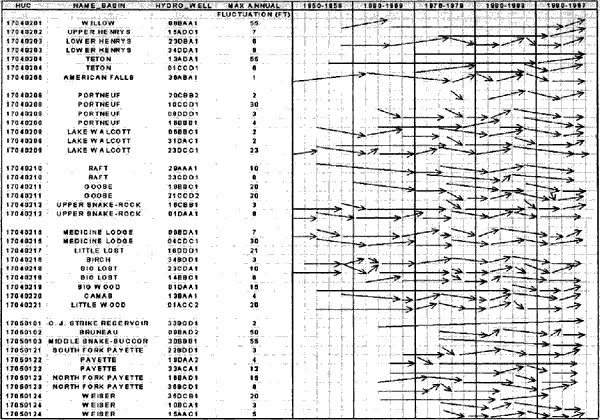
Most wells show annual fluctuations of less than ten feet. Notable exceptions
include wells in Bruneau, Willow, and Teton where annual fluctuations can vary
to a maximum of 50 to 65 feet .
The figures below summarize the water table data. The first figure list
locations of wells used to illustrate changes in ground water levels.
The second figure illustrates the fluctuations in the water table over time.
Click here to view image.
 figure
1.
figure
1.
Information supplied by Idaho
Water Resource Research Institute, University of Idaho December 1998
Authors: Dr. Gary Johnson, Donna Cosgrove, and Mark Lovell.
Graphics: Sherry Laney and Mark Lovell of Idaho Water Resource Research Institute.
All State of Idaho images and graphics created with GIS files obtained through
Idaho Department of Water Resources Public Domain GIS unless otherwise noted.
Source
Information