|
|
|
CLICK
for to do a
Surface Water Review |
|
|
|
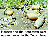
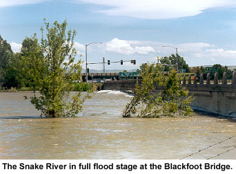
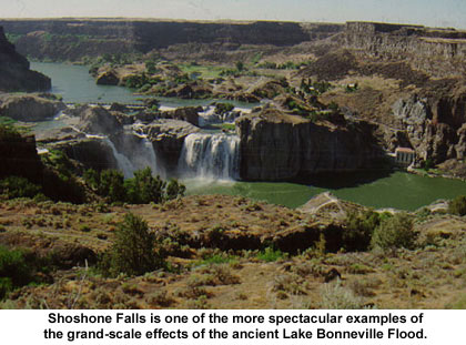
Look
at some flood pictures: |
|
|
|
Look
at a
few facts about the distribution of water in Idaho.
|
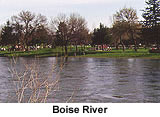
Idaho, known as the Potato State, could just as logically be called the river state. We have over 93,000 thousand miles of rivers, streams and creeks, in addition to 1,000s of lakes and reservoirs, and these waters are deeply connected to most Idahoans lives. We float them, fish them, swim in them, irrigate with them, and generate power with them. They have shaped the landscape of the entire state - both at normal flow levels, and when in flood stage.
How we use our riverways is an on-going issue for Idahoans. Consider these facts about how we use Idaho's rivers:
* Idaho Rivers are home to 19 species of fish that are listed as endangered, threatened, or of "special concern."
* 420,000 anglers fish on Idaho rivers annually.
* Idaho has over 3100 miles of whitewater suitable for rafting, kayaking or canoeing.
* 2000 miles of Idaho's rivers are designated as State Protected Rivers through conservation groups and citizens.
* Over 400 miles of Idaho's Rivers have minimum streamflow water rights, which help protect fish, wildlife, water quality, and recreational values.
* 577 miles of Idaho rivers are currently designated as National Wild, Scenic or Recreational Rivers.
* Idaho water produces nearly 1/3 of the US potato crop.
* There are over 232 major dams and 777 major irrigation diversions on Idaho rivers.
* Idaho hydropower generates enough electricity for 320,000 to 340,000 all-electric homes built to energy efficient standards or 175,000 built to the present state standard.
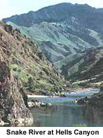
Most of Idaho's rivers and streams flow into one of 5 major river basins; the Snake, the Clearwater, the Salmon, Bear, and the St. Joe. These rivers have been important parts of Idaho history from travel routes for early explorers, to industrial, domestic, and recreational resources for today's Idahoans. In the pages of this atlas you can explore some of the natural history of the regions drained by these great rivers.
Streamflow
and Precipitation
A basic understanding
of units of measurement and data reporting in hydrology are required to use
the data bases and coverages of Idaho hydrology and precipitation found on
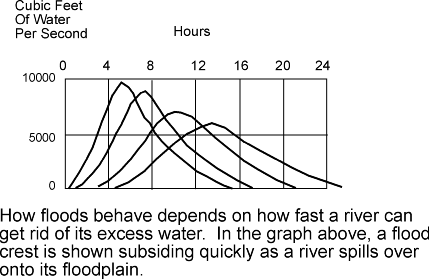
the Atlas. The basic unit of streamflow in the United States is cubic feet
per second (cfs), or the volume of water that flows past a cross-section of
a river in a second. Most of the data found here is based on the daily mean
discharge, which is the average cfs for all seconds in a day. The mean annual
discharge is the average of all daily mean discharges in a year. Precipitation
is reported as a depth. To fully understand the data, it is useful to understand
how that data is collected.
Continue to page 2.