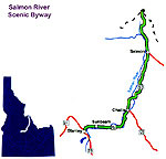
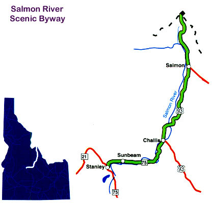
Salmon River
Scenic Byway
CLICK
for full-size view
Location
From Stanley east on Idaho 75 to U.S. 93 at Challis and north to the Montana
state line.
Length
161.7 miles. Allow 3.5 hours.
Roadway
Two-lane road with no passing lanes and some 25-mph curves.
When to see it
Best weather for travel is April to November, although access to the back
country is best from July to October.
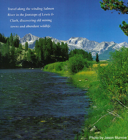
Special attractions
Salmon spawning beds at Indian Riffles; Land of the Yankee Fork Interpretive
Center at Idaho 75 and U.S. 93; Tower Rock; access to Continental Divide National
Scenic Trail; access to Lewis and Clark National Historic Trail; access to
Nez Perce (Nee Mee Poo) National Historic Trail; Salmon Wild & Scenic
River; Middle Fork Salmon Wild & Scenic River; Salmon-Challis and Sawtooth
National Forests.
CLICK
for full-size map