Yellowstone
Volcanic Plateau
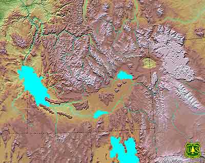
One million years ago the
hot spot was located beneath the Yellowstone Volcanic Plateau. Both the Huckleberry
Ridge and the Henry's Fork calderas had formed, the latter by the eruption of
the Mesa Falls Tuff. The high terrain of the northern Rocky Mountains spread out
like an eastward-pointed crescent from the hot spot. The map shows a Pleistocene
glaciation at its maximum. Lakes on the Snake River Plain were, from west to east,
Lake Idaho, Raft Lake, and Lake Terreton. Continuation of Basin and Range extension
had thinned the crust so that basalt magma, melted from mantle lithosphere by
the hot spot, reached the surface and produced extensive basalt lava fields across
the Snake River Plain. The Snake River had begun to cut Hells Canyon, its entry
into the Salmon-Columbia River system. The Salmon River had begun to cut its steep
canyons westward across the Idaho Batholith. Topographic subsidence of the eastern
Plain had captured the headwaters of the Snake River in Jackson Hole, thus moving
the continental divide northeastward into Montana and Wyoming. The Big Lost River
drained southeastward, its water sinking into the basalt and joining the Snake
River Aquifer. The Bear River near Montpelier likely flowed northward into the
Snake, reversing its former southeastward course.
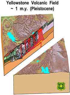
Yellowstone Volcanic
Plateau
Cross-section of the
plateau.
Images courtesy of the U.S.
Forest Service, Department of Agriculture.