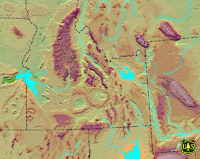
Twin Falls & Picabo
Volcanic Fields
About 10 million years ago,
the Yellowstone-Snake River Plain hot spot system was fully active, forming the
Twin Falls and Picabo volcanic fields. The hot spot was located beneath the western
edge of the Archean North American continental craton. About this time, the rate
of plate movement over the hot spot decreased from about 7 cm/yr to about 2.9
cm/yr, and the direction of movement changed by about 25 degrees counterclockwise,
eastward to northeastward. South-central Idaho was topographically uplifted into
a tumescent bulge, thermally inflated by volcanic heat. Volcanism on the Owyhee
rhyolite plateau had ceased and early Basin and Range faulting produced lacustrine
basins east of the hot spot. Lake Idaho, a closed basin lake in the western Snake
River Plain, occupied a northeast-tilted half-graben on the northwest shoulder
of the topographic bulge. The continental divide moved northeastward, following
the relative movement of the hot spot. South-flowing streams drained into the
developing Bonneville Basin and the northward drainage of a proto-Salmon River
flowed into eastern Montana.
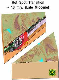
Twin Falls & Picabo
Volcanic Fields
Cross-section of the
plateau.
Images courtesy of the U.S.
Forest Service, Department of Agriculture.