 Understanding
Topographic Maps
Understanding
Topographic Maps
Understanding
Topographic Maps
General
Information
The terms below
indicate what information is contained on a topographic map, and where it can
be found.
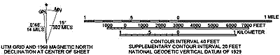
Map Scale: Maps come in a variety of scales, covering areas ranging from the entire earth to a city block (or less).
Vertical Scale (contour interval): All maps have a horizontal scale. Topographic maps also have a vertical scale to allow the determination of a point in three dimensional space.
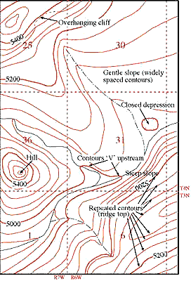
Contour Lines: Contour lines are used to determine elevations and are lines on a map that are produced from connecting points of equal elevation (elevation refers to height in feet, or meters, above sea level).
The following are general characteristics of contour lines:
1. Contour lines do not cross each other, divide or split.
2. Closely spaced contour lines represent steep slopes, conversely, contour lines that are spaced far apart represent gentle slopes.
3. Contour lines trend up valleys and form a "V" or a "U" where they cross a stream.
On most topographic maps, index contour lines are generally darker and are marked with their elevations. Lighter contour lines do not have elevations, but can be determined by counting up or down from the nearest index contour line and multiplying by the contour interval. The contour interval is stated on every topographic map and is usually located below the scale.
Creating topographic profiles: Remember that topographic maps represent a view of the landscape as seen from above. For producing a detailed study of a landform it is necessary to construct a topographic profile or cross-section through a particular interval. A topographic profile is a cross-sectional view along a line drawn through a portion of a topographic map.
A profile may be constructed quickly and accurately across any straight line on a map by following this procedure:
a. Lay a strip of paper along a line across the area where the profile is to be constructed.
b. Mark on the paper the exact place where each contour, stream and hill top crosses the profile line.
c. Label each mark with the elevation of the contour it represents.
d. Prepare a vertical scale on profile paper by labeling the horizontal lines corresponding to the elevation of each index contour line.
e. Place the paper with the labeled contour lines at the bottom of the profile paper and project each contour to the horizontal line of the same elevation.
f. Connect the points.
Stream Gradient: Stream gradient can also be determined from a topographic map. The gradient of a steam or river is determined by measuring a section of a stream or river and dividing the distance (in miles) into the vertical difference (in feet) between the two points. The result is expressed in feet per mile (ft./mi.). The equation used is:
|
Gradient
=
|
drop in elevation between two chosen points (feet) |
| distance between the two points (miles) |
Tips
for Interpreting Topographic Maps
Vertical
exaggeration:
Vertical exaggeration is the effect that is created when the horizontal and
vertical scales on your topographic profile are not the same.
Determining hillslope: Among other things, a topographic map can be used to measure the average slope of a hill (or hills).
 |
| Click on image for a larger view. |
Topographic
Map Example
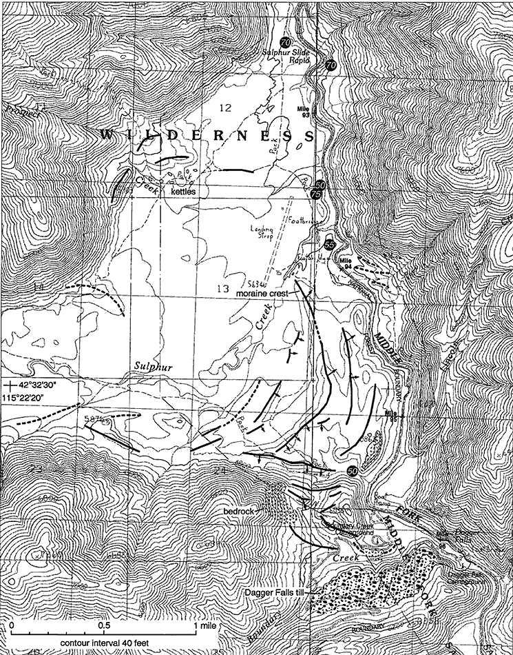
As an example,
look at a map of the Sulphur-Boundary Creek area along the Middle Fork of the
Salmon River This map is a geologic map of glacial geology in the area, drawn
on a topographic map base. The map has a contour interval of forty feet,
which means that every place between the marked 6800 foot line and the next
lowest line (which is 6760 feet, and not marked) has an elevation equal or greater
than 6760 feet, but less than 6800 feet. You can figure out the elevation of
any point by finding the nearest labeled line, counting the number of lines
above or below it, multiplying by the contour interval, and adding or subtracting
the result from the nearest marked contour line. The more closely spaced the
contour lines, the steeper the slope. You can find out exactly how steep the
slope of the area you are interested in by subtracting the lowest elevation
from the highest, and dividing the result by the horizontal distance. Horizontal
distance is found on the scale. As you look at the map, notice that the contour
lines enclose smaller and smaller areas. The smallest circles represent the
tops of peaks, and some are marked with x’s with numbers next to them.
The numbers are the elevation at the top of the peak.